The Three Peaks area of the Yorkshire Dales
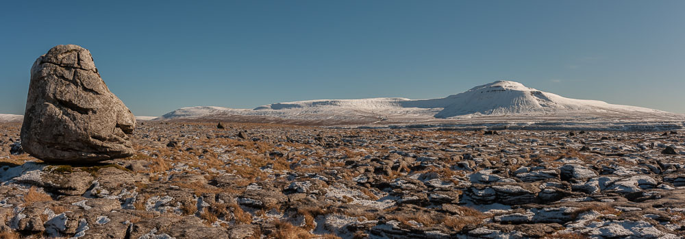
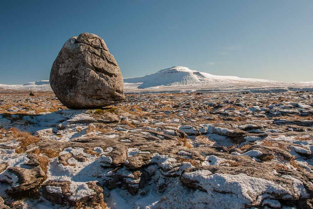
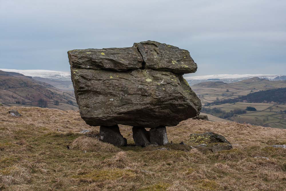
The area around the Three Peaks of Yorkshire is one of my favourite parts of the world and this is one of my favourite locations within it. Known simply, by me at least, as “The Boulder”. The boulder is an “erratic” left isolated on the limestone plateau of Scales Moor by receding glaciers at the end of the last ice age. Technically, I am not sure that it is a true erratic since it is made of the same rock as that on which it is standing; classic erratics are of a different material carried long distances from their source before being deposited.
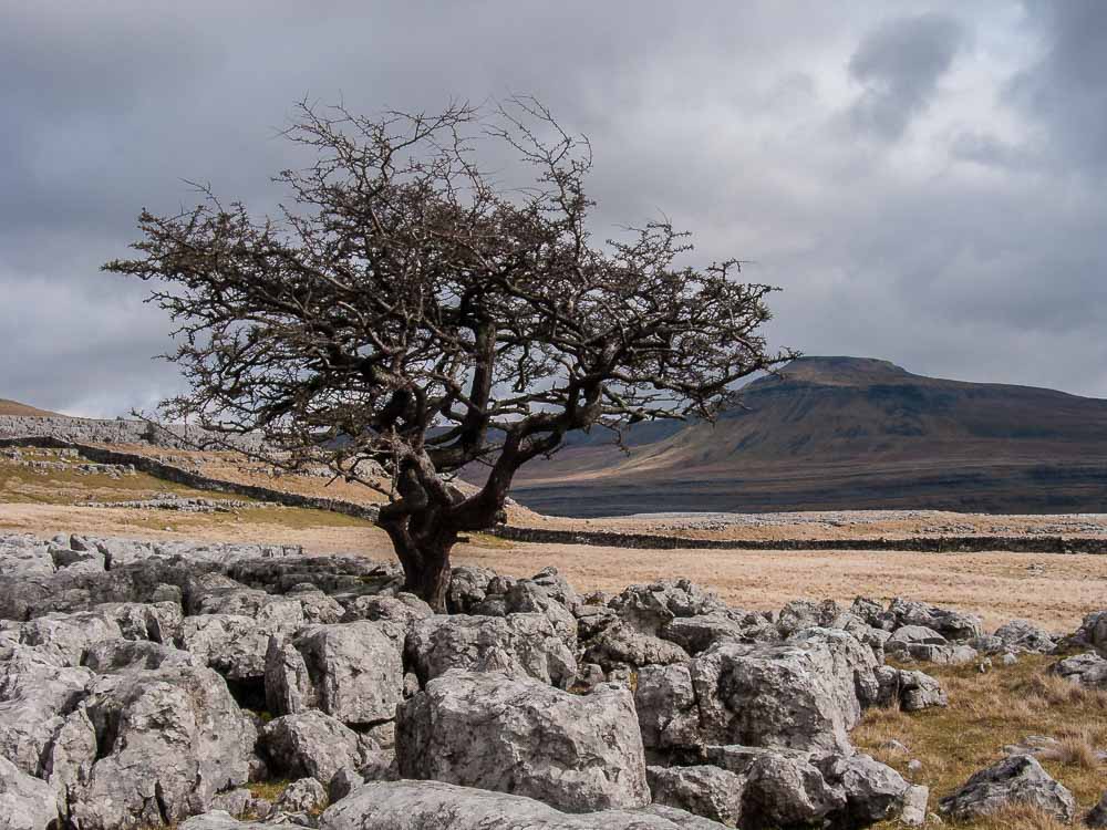
The photos above were taken in March on a gloriously cold and clear day. The hill in the distance is Ingleborough, one of the three peaks, the other two being Whernside and Pen-y-Ghent. On this day I walked from Ingleton village along the Beezley Falls path, over Scales Moor, through Chapel Le Dale, over Ingleborough and down into Clapham. The route up Ingleborough goes straight up the side that is in shadow to pick up the summit ridge. On this day I regretted not having my ice axe and crampons with me which was not something I expected to need in the Yorkshire Dales.
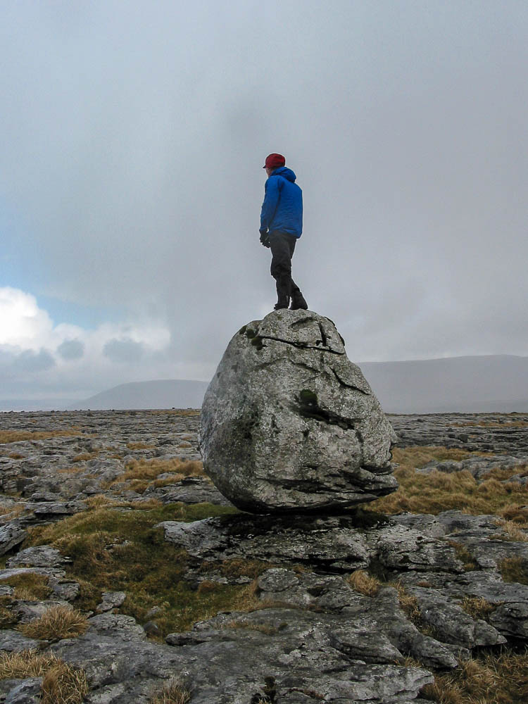
This gives you an idea of the size of the boulder. Not massive, but substantial and nothing else close to its size all around.
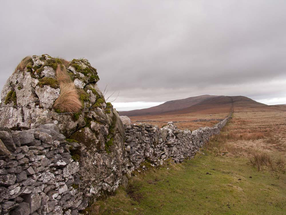
There is one similar boulder nearby, off the exposed pavement area, that has been used by the local land owners, incorporating it into a drystone wall which snakes its way up onto Whernside. I wonder whether this boulder was moved to fit the wall location or vice versa? I suspect the latter given the size and weight of these things.
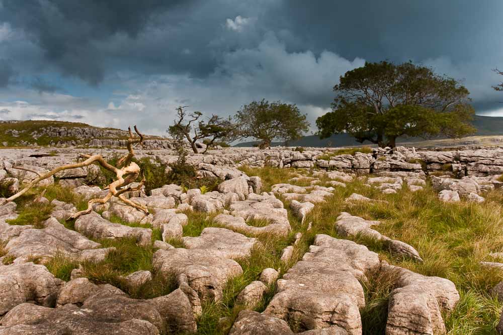
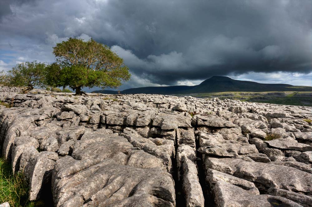
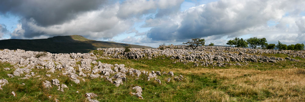
Scales Moor again, this time in September with a storm gathering over Ingleborough. Scales Moor is a fine example of a limestone pavement and in my experience is rarely visited by walkers, you can usually have the whole place to yourselves and as it is open access land you can pretty much wander where you like. However, be prepared to find your way home with a map and compass as the weather here can get you into trouble very quickly.
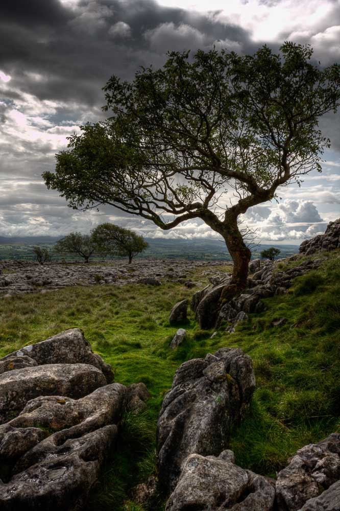
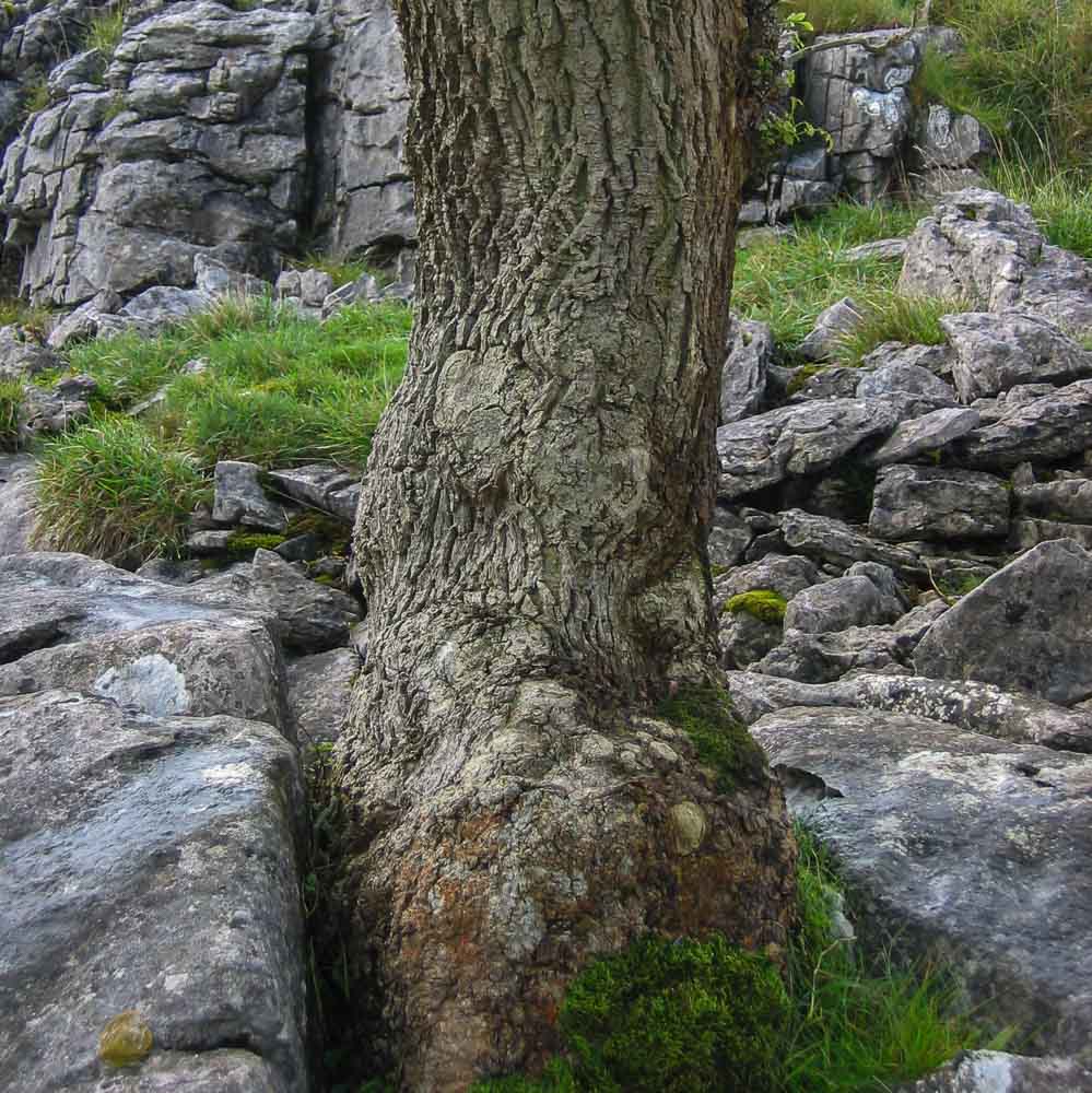
The trees on the pavements always amaze me how they manage to survive. They seem to be growing on what is essentially bedrock; their roots penetrating the cracks in the limestone and exploiting whatever nutrients they can get. Their short, twisted growth testament to the harsh climate and strong winds.
The pavements were once wooded, trees growing in the soil / silt left behind by retreating ice sheets. However, the trees were mostly cleared by felling and grazing by domestic animals which lead to the erosion of the soil and exposure of the pavements. Some older trees survive and have become Bonsai-like in appearance. This is a Hawthorn growing on Twistleton Scar End above Ingleton.
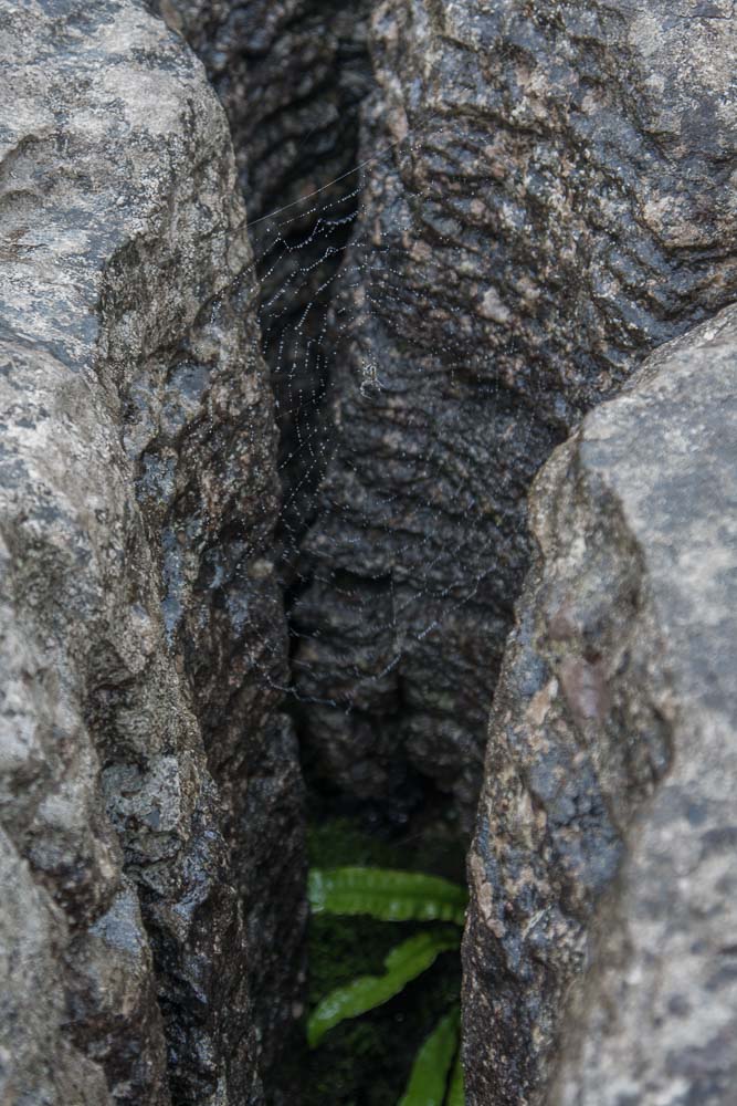
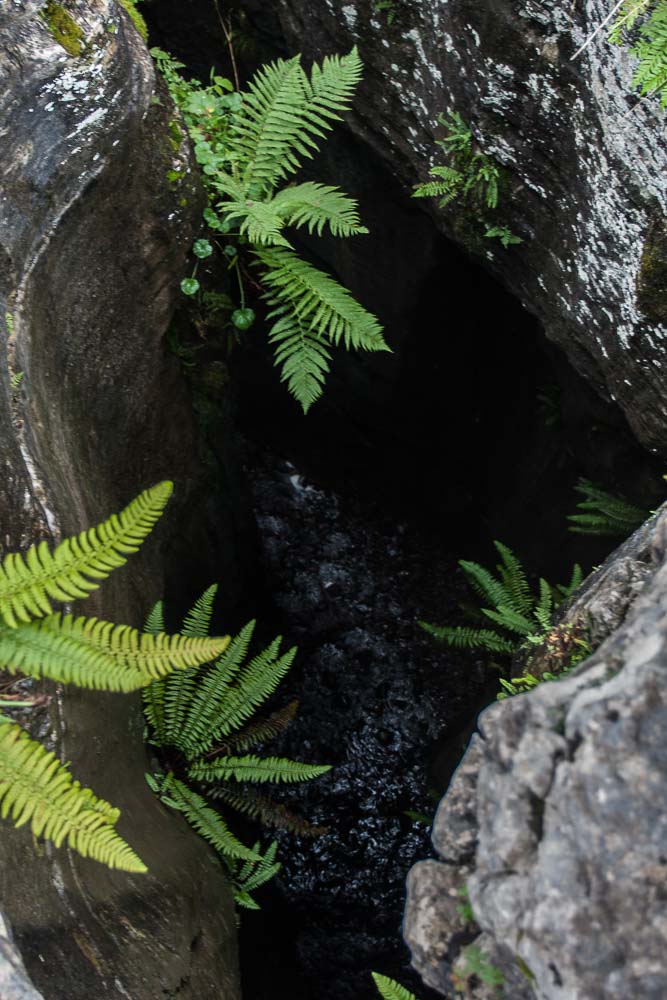
As any geography student will tell you limestone pavements have clints and grikes, where the clint is the block of limestone and the grike is the fissure between the blocks. The grikes provide shelter for some interesting flora and fauna and occasionally the wider crevices serve as graves for wandering sheep.
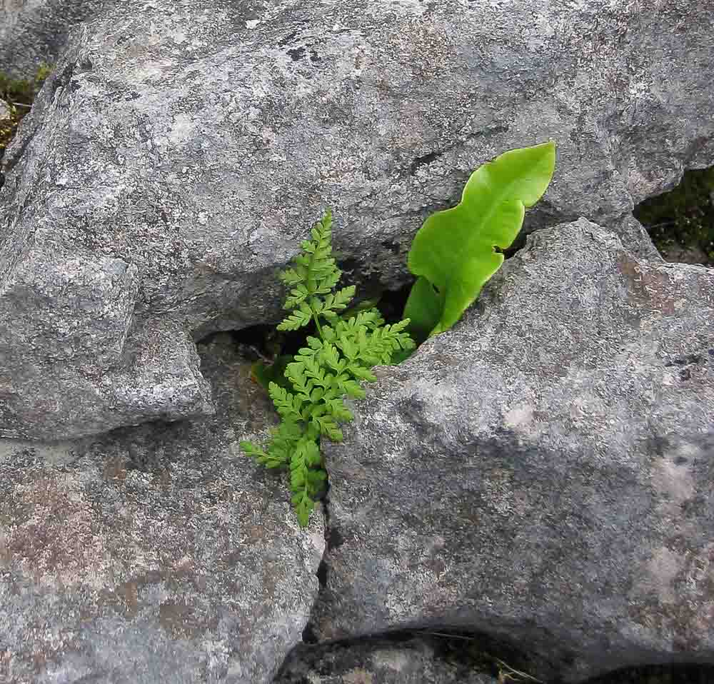
Harts tongue fern (Asplenium scolopendrium) on the right and possibly a Spleenwort on the left. On my bucket list is to spend some time on the pavements photographing more of these typical plants. Plants with names like Dark Red Helliborine (Epipactis atrorubens), Mountain Avens (Dryas octopetala) and Downy Currant (Ribes spicatum).
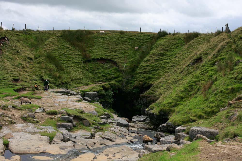
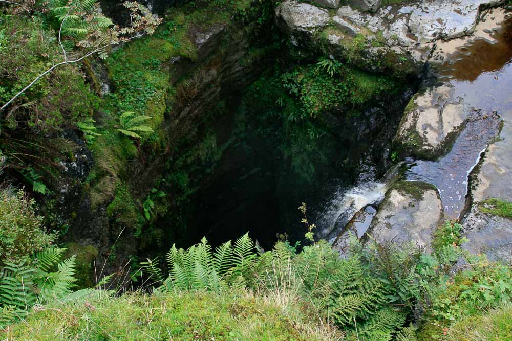
Of course limestone areas are most famous for their caves and potholes and this is probably the most famous in the Yorkshire Dales, Gaping Gill (or Ghyll). Here, Fell Beck plunges 100 metres (328 feet) to the floor below. At weekends the chamber below can be busy with cavers who have entered the system via other, less vertiginous, entrances. Walkers above will have no idea that beneath them is a busy underground chamber and I have seen people, particularly children, take great delight in hurling rocks down the shaft, completely oblivious to the possibility of people below. There ought to be a sign.
I had the privilege of abseiling down the shaft in the late 1970s as a member of a caving club. I had thought that it was a privilege for me to be allowed to go first, as the youngest in the party. However, the descent did not go well and to cut a long story short the new rope, purchased specifically for the purpose, was probably not the best choice. We were using a new, nylon, hawser laid, rope which unfortunately twisted uncontrollably when I started to descend on it. Instead of the descent being an enjoyable, thrilling, experience it was a frustrating, stilted, journey of untwisting metres of rope beneath me and feeding them laboriously through my descender. The further I descended the more twisted and tangled the rope beneath me became. Fortunately, I made it to the bottom under my own steam but was the first and last to descend on that day, no doubt much to the frustration of my club mates although no-one said so at the time.
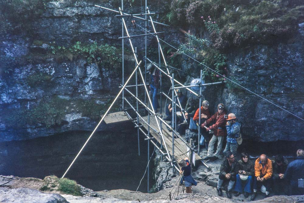
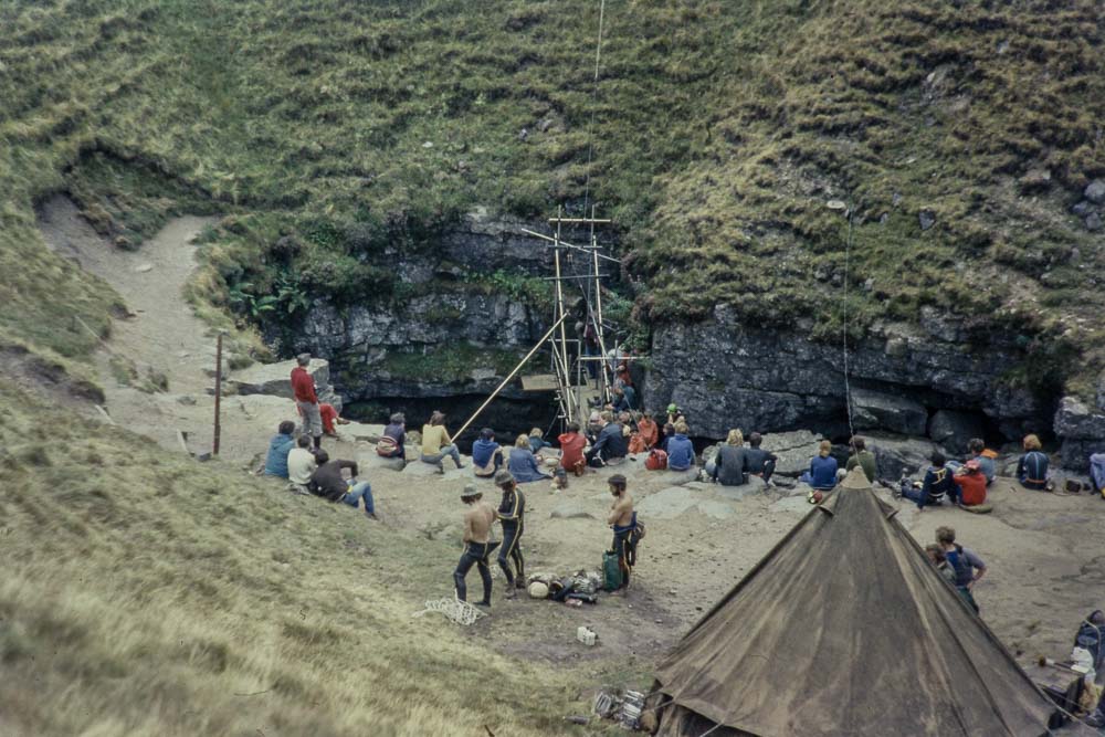
It is possible for anyone to descend the shaft in a much more controlled manner as twice a year there is a winch erected over the shaft to lower you down; at the end of May, run by the Bradford Pothole Club and at the end of August, run by the Craven Pothole Club. These photos were taken in 1975 but the traditional winch meets still occur today.
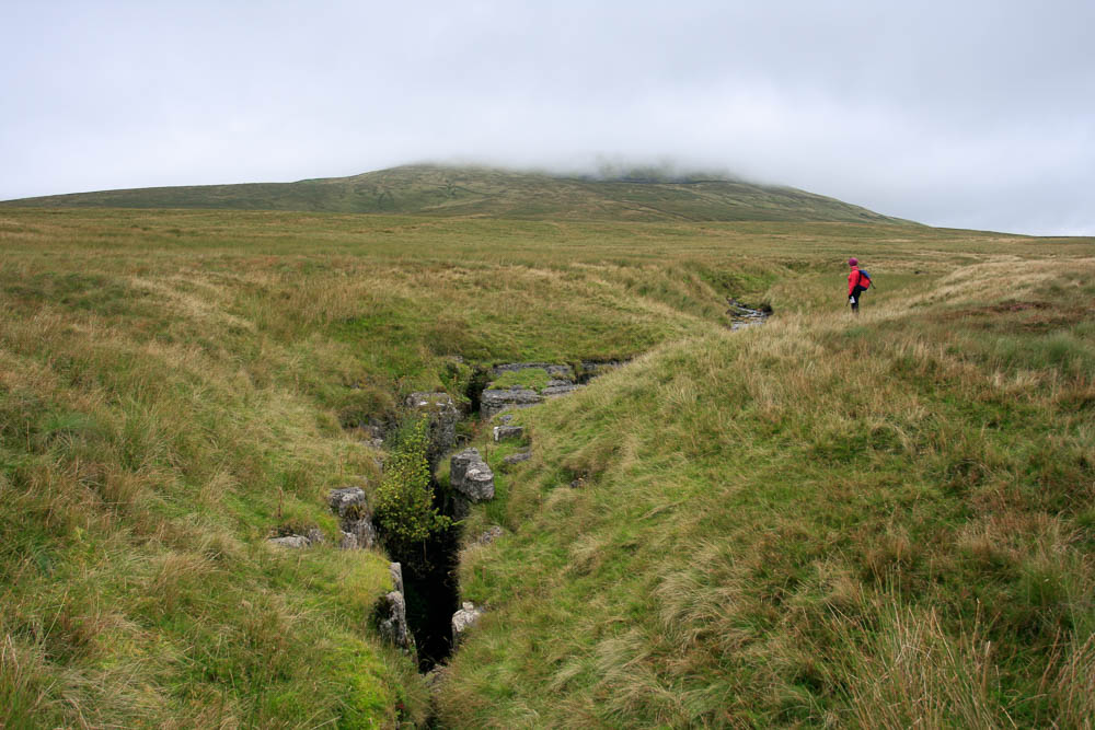

Near to Gaping Gill is another pothole called Juniper Gulf. This is named after the Juniper bush which can be seen in the middle photo above, growing out of the rock on the left hand side, beneath some heather. The entrance shaft is 18 metres and further shafts take you down to a a total depth of 128 metres.
Back to those erratics and this is what I would call a classic of the form. This is one of the Norber erratics above Austwick. It is a boulder which is different from the underlying bedrock, so it definitely did not come from round here. The boulder consists of dark hard sandstone lying on a plinth of three limestone blocks. The sandstone is much older than the limestone and so, in geological sedimentation terms, should be beneath it. Ice age glaciers have carried the sandstone from the valley floor up onto the limestone plateau and the harder sandstone has protected the limestone beneath it from erosion by rain, leaving it perched above the surrounding bedrock.
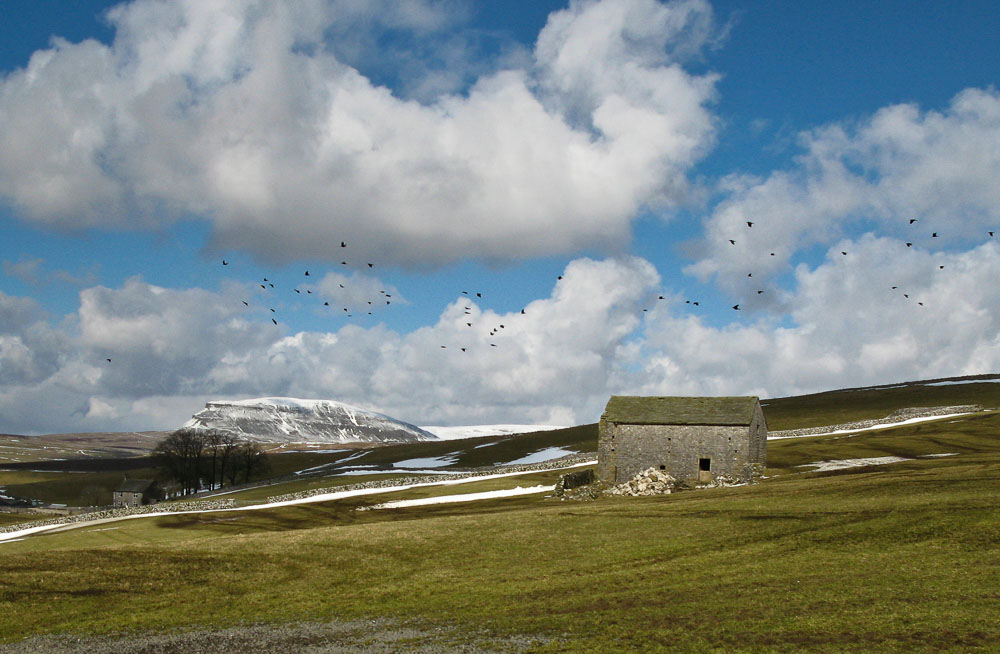
A view of Pen-y-Gent from the road between Stainforth and Malham. The building in the foreground is a field barn, typical of those found in the Dales. These barns date back to the 18th and 19th century. The fields surrounding the barn would have grown a crop of hay which would have been cut and stored in the barn. Over winter, cattle were housed in the byre end of the barn and fed on the hay stored in the other or in the loft. At this time farmers preferred several isolated herds grouped around the barns rather than a larger centralised herd nearer the farmhouse, despite the distances that they must have travelled between barns and in winter conditions.
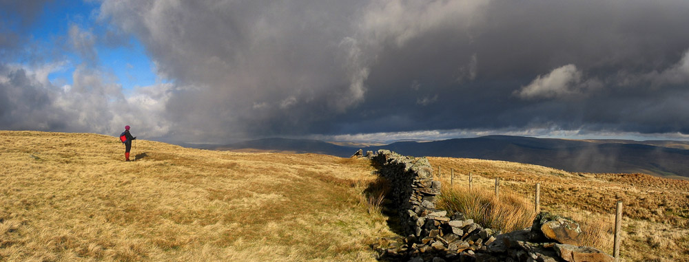
Walking over Souther Scales Fell towards Park Fell. Ingleborough is behind the photographer.
The three peaks area is known for the Three Peaks Walk; a circular walk over Pen-y-Ghent, Whernside and Ingleborough. The distance is about 25 miles and includes nearly 1600m (5250 feet) of ascent and descent and some boggy, energy-sapping, sections, especially between Pen-y-Ghent and Whernside, if my memory serves me correctly. It is not a difficult walk but the terrain and the weather can take their toll.
This is one of my favourite photographs and it was taken on my least sophisticated of digital cameras, a Canon G2. It was three images stitched together using Canon’s own software.
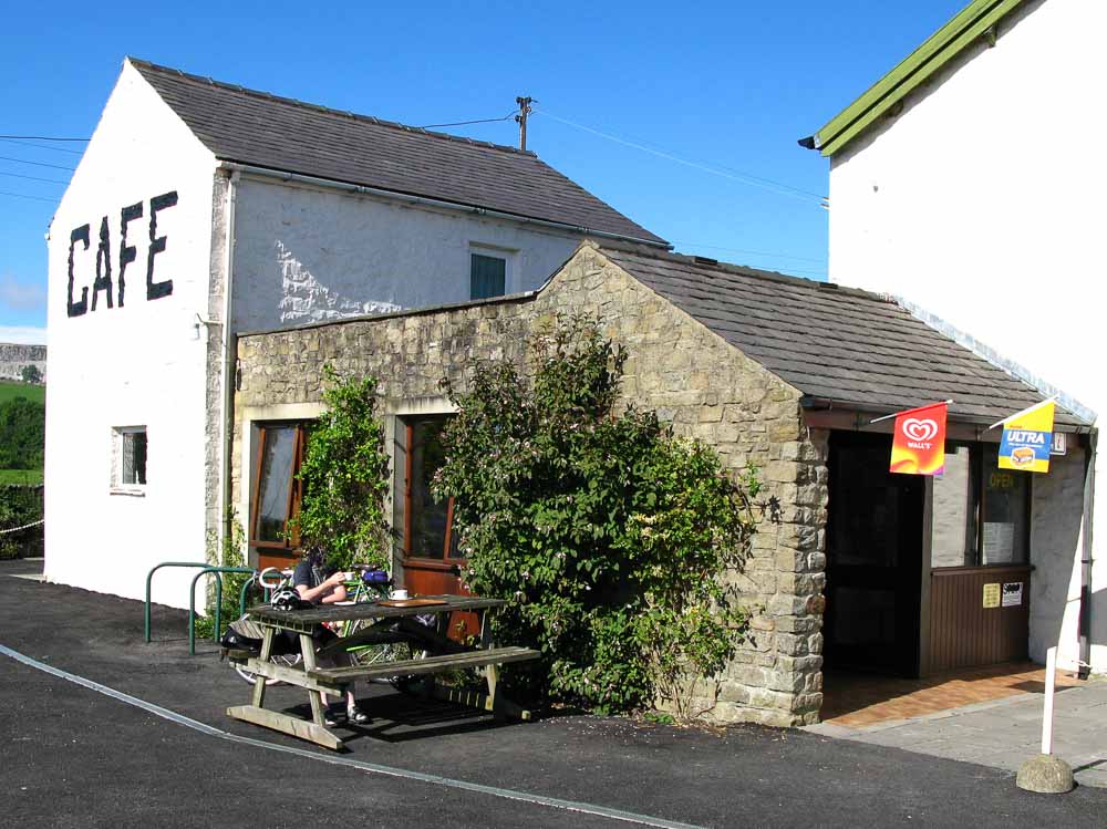
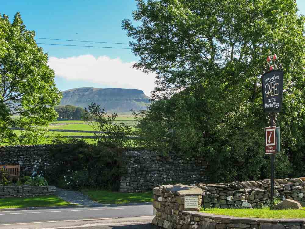
The Three Peaks Walk traditionally starts at the Pen-y-Ghent Cafe in Horton in Ribblesdale. The cafe operates a clocking in and out system and if you complete the walk within the 12 hour limit you are invited to join their Three Peaks of Yorkshire Club. I don’t think there are any benefits from being a member, you don’t get discounts in the cafe for example, just the kudos of having completed the challenge and having a badge to prove it. Nothing wrong with tea and medals after a hard day in the hills. The cafe does a fine pint of tea.
Personally, these days I would recommend starting your challenge from somewhere else to avoid having to walk around the route with a large crowd of others. Other possible starting points are Ribblehead, doing Whernside first or Chapel Le Dale doing Ingleborough first. However, there are guided versions of the challenge which I note start from Chapel Le Dale so it may be worth checking their dates before setting your own; unless of course you wish to join a guided challenge.
Whernside from the flanks of Ingleborough.
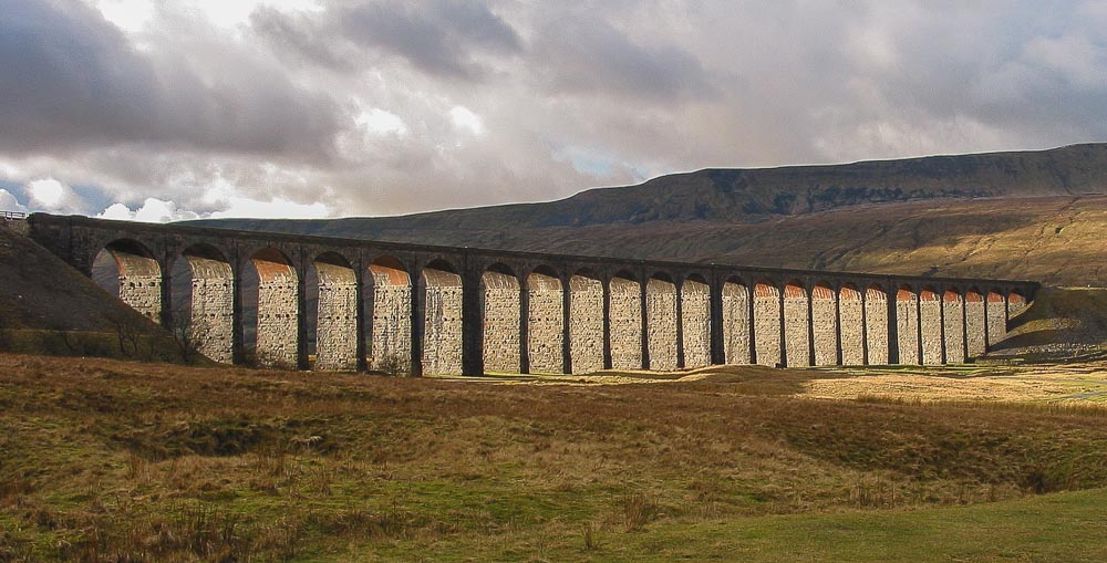
The Ribblehead viaduct (and the nearby Blea Moor Tunnel) is now starring in ITVs epic period drama “Jericho” which is set in the shanty town which grew up around the viaduct during the four years taken to build it from 1870 to 1874. The viaduct was designed by engineer, John Sydney Crossley. A thousand navvies (or see below) built the viaduct and established shanty towns on the moors for themselves and their families. The towns were named after Crimean War victories, well-to-do districts of London and biblical names, includig Sebastopol, Belgravia and Batty Wife Hole. There were smallpox epidemics and deaths from industrial accidents. Around one hundred navvies were killed during its construction. There are around 200 burials of men, women, and children in the graveyard at Chapel-le-Dale. The church there has a memorial to the railway workers and is worth a look if you have the time during your three peaks challenge.
Here is an extract from the London Daily Times, 29th October 1872 to give an indication of what we would have seen in the area beneath the viaduct at that time:
“The becks and gills which plunge impetuously down the steep mountain sides are so many rills of silver; and as the sun falls upon the smoke that is lazily drifting upward from the chimneys of Batty Wife Hole, even that dismal abiding place of navvies looks almost picturesque in the distance. I am just in time to miss Mr Ashwell, the contractor, who, I am told, has gone “up the line”; and I set out to follow him. “The Line” is a temporary way which winds deviously across the hollow, already partly spanned by the huge skeleton viaduct. I scramble along, somehow, through knee deep bogs, onto piers whose foundations are just level with the surface, past batches of stone-hewers hammering away industriously at great blocks of blue stone for the piers of the viaduct; then I find myself among these and in the labyrinthine scaffolding that encircles them – looking up at trucks and engines traversing tramroads at a dizzy height, at derricks, at blocks, and pulleys, at noisy little fixed engines, and at silent busy masons.”
Here is some drone footage of a steam train going over the Ribblehead viaduct. Trust me, you will like this. I liked it a lot, fantastic photography and some great music as well. Well done to Stu Gledhill (Kitestu).
The Settle and Carlisle Railway Trust has restored the station at Ribblehead and the station masters house is available for rent as a holiday cottage. This would be an excellent location from which to explore the area, but be warned the weather here can be brutal at any time of year.
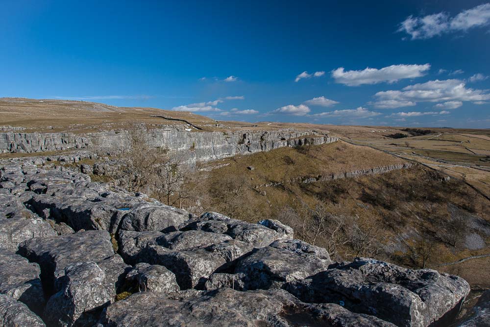
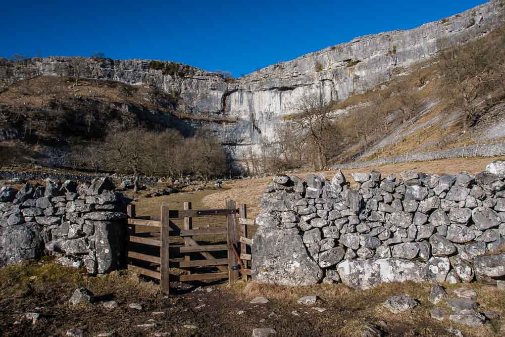
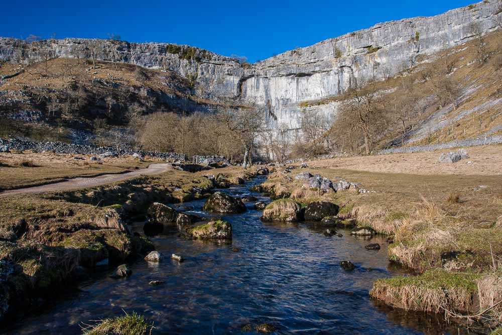
And finally, for now, a picture of Malham Cove, a dry (usually) ancient ice age waterfall 80 metres (260 feet) high. I say usually because in December 2015 following storm Desmond, which brought heavy flooding to parts of Yorkshire, Lancashire and Cumbria, water once again flowed over the top of the cove. I watched a video on the internet in amazement, having been there many times over the last 40 years I would never have thought that was possible. I wish I could have seen it at first hand.
You can watch an excellent video of the spectacle here. This one is also by Stu Gledhill (Kitestu). Thanks again to Stu. The moment is preserved forever by the power of video and selflessly shared for all to enjoy. If you haven’t watched Stu’s Ribblehead footage then you must! Here is that link again.